Hull City Council has launched a six-week public engagement exercise to get feedback from residents, businesses and commuters on proposals to address two congestion pinch points in and around the west and north of the city.
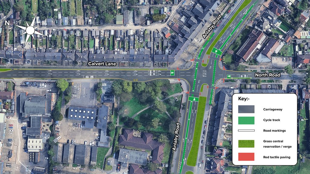
From Monday 2 November 2026, people can view and have their say on proposed changes to three key parts of the city’s road network – the Calvert Lane/North Road/Anlaby Road junction, the Spring Bank West and Willerby Road roundabout and Roebank roundabout.
These locations have been identified as priority sites for improvement as part of a proactive plan by the council to futureproof the network and prepare these areas for an anticipated increase in traffic volumes in the years ahead.
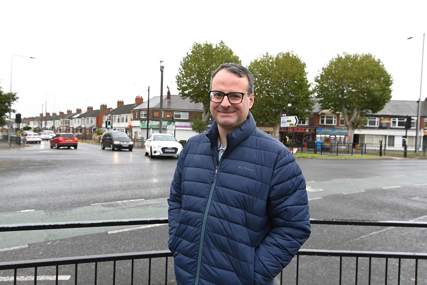
Councillor Mark Ieronimo, cabinet portfolio holder for transport and infrastructure at Hull City Council, said: “We know that congestion at busy junctions can be frustrating for residents and commuters, which is why we are looking at ways to improve traffic flow and make journeys more reliable.
“As Hull continues to grow, it is important that we plan ahead and invest in our road network to meet future demand, rather than simply waiting for problems to get worse.
“We are already making significant improvements to junctions in Kingswood, and these proposals represent the next stage of our work to improve capacity across the city.
“Both schemes also include improvements for pedestrians and cyclists, and I would encourage residents, businesses and everyone who uses these junctions to look at the plans and tell us what they think.”
The council will be seeking feedback on the schemes separately.
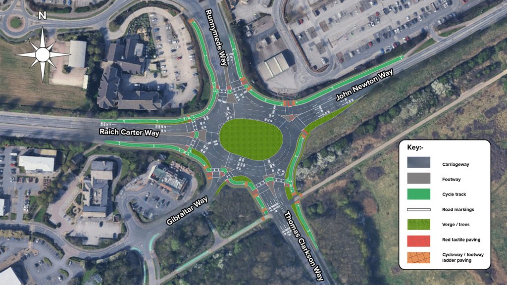
Roebank Roundabout Capacity Improvement Scheme
This scheme is designed to increase capacity at the roundabout, with the aim of reducing congestion and improving journey reliability while also enhancing safety and active travel facilities by:
- converting the existing roundabout into a signal-controlled roundabout, improving traffic management and enabling more efficient operation of the junction
- enhancing walking and cycling infrastructure, including new toucan crossings and segregated off-road cycle routes to provide safer and more accessible connections
- improving safety by introducing signal-controlled crossing facilities on all approaches to the junction, allowing pedestrians and cyclists to cross safely where some arms currently have either no crossing provision or unsignalised facilities
- widening the carriageway to provide additional traffic lanes and increasing the network capacity, helping to reduce journey times and queuing
- selectively removing some trees to facilitate widening works, with replacement planting at a ratio of two new trees for every one tree removed
- resurfacing the carriageway and footway to improve their condition, durability and long-term performance.
See the plans and have your say
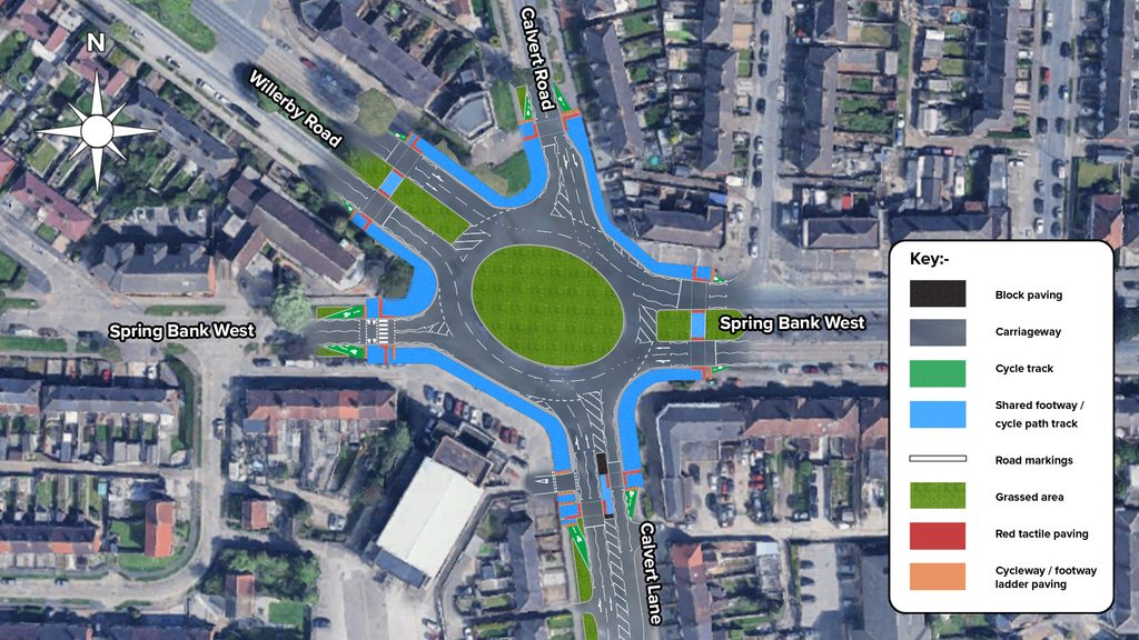
Calvert Lane Capacity Improvement Scheme
This scheme is designed to increase capacity at the junction and roundabout, with the aim of reducing congestion and improving journey reliability while also enhancing safety and active travel facilities through:
- the introduction of signal-controlled crossings, providing dedicated crossing opportunities for pedestrians and people cycling as well as moving cyclists onto off-road facilities
- enhancing walking and cycling infrastructure, including new toucan crossings, a parallel crossing, a new pedestrian refuge island on Calvert Lane and new shared-use footway and cycleway links
- widening the carriageway to provide additional traffic lanes on southbound Calvert Road and northbound Calvert Lane
- extending existing lanes on southbound Calvert Lane and the eastbound and westbound right-turn lanes on Anlaby Road to help reduce queuing
- removal of a limited number of trees, to accommodate widening, with replacement planting provided at a ratio of two new trees for every tree removed
- resurfacing the carriageway and footways to improve their condition, durability and long-term performance.
See the plans and have your say
In addition to being able to view the proposals and provide feedback online, the council will also be hosting public drop-in sessions in both areas in late November, with dates, times and locations for these to be announced nearer the time.
The public engagement exercise will run until Monday 14 December 2026 and will help further develop and refine the proposals for consideration and approval by Cabinet for delivery, subject to funding allocations within the council’s capital programme.